Maximum Flooding Surface (MFS)
By F. Qayyum
This is a short post about the MFS that is considered as an easy to identify on outcrops and well data because of some reasons. This post would covers the fundamentals of placing a MFS in a stratigraphic unit and how to avoid pitfalls in its interpretation.
Definition
It is a surface that marks the end of shoreline transgression towards land or coastal plain. It suggests a base level rise and subsequent marine transgression onto the shelf or coastal plain.
Recognition
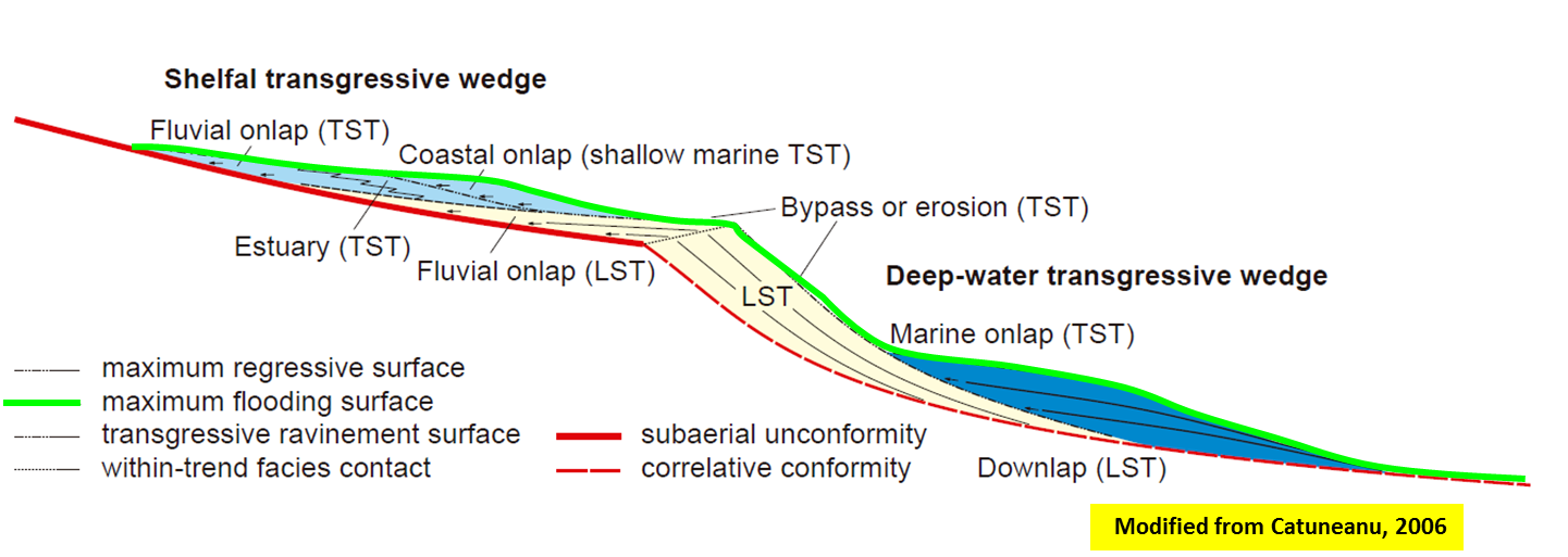
It can be treated as a downlap surface because overlying strata may prograde and downlap on it. This is a typical case for a normal regressive deltaic progradation or simply siliciclastic system reaching the shoreface and basin. The overlying system could either be a HST or LST depending on the location.
On the well logs, it is marked by a deepening up-ward GR trend. This means that one is going to mostly define a massive shale as a MFS marker at a shelf location or in the basin. Back-stepping stratal stacking patterns in the outcrops and also in the seismic data are also useful tools to recognize this surface.
In non-marine intervals, it is difficult to identify the back-stepping patterns. For instance, in the fluvial settings, a rise in base level will flood the floodplains and thereafter a MFS starts developping. Note that in such a case, the stream rejuvination is less than the stream aggradation that could be used as a reference to placing MFS soon before the stream rejuvination starts or base level starts falling. The grain size would serve a reference in such a case.
Advantage
It helps in characterizing as stratigraphic interval as one can use it as a reference surface to identify the source and seal. On seismic data, it can be used to identify stratigraphic traps.
Common Pitfalls
People say that this is an easy to identify surface. But this is not always the case. Not all shale markers are the MFS or FS. It is also difficult to be mapped in the deep-water settings as the strata there do not show back-stepping geometries clearly and also the deep water settings may mostly show a shale prone interval. Same is the case for a floodplain dominated by clay rich setting even if the base level oscillates at every kilo-year.
MFS should be marked or interpreted by integrating various datasets. It should not be placed blindly by looking at the well motifs and calling all shale markers as MFS markers.
MFS could also be scoured and re-worked by storms or a later sedimentary process. In such a case, it could be a separation between two coarsening up-ward trends as indicated by Catuneanu (2002) in his book. A similar case may also occur in a back-stepping beach settings where you may noticed stacked beaches and thereafter the MFS could also be placed at the top of a preserved beach. If no transgressive strata is preserved, you may notice that MFS is adjoining with MRS.

According to Embry (2009) or his previous texts, the MFS is a material-based surface as it defines the rise in base level. For those who do not know about the material-based surface nomenclature, here is a text taken from Embry's paper:
A material-based surface is defined on the basis of observable physical characteristics which include 1) the physical properties of the surface and of overlying and underlying strata and 2) the geometrical relationships between the surface and the underlying and overlying strata.
References
Catuneanu, O. 2006. Principles of Sequence Stratigraphy, Elsevier.
Comments
Post a Comment